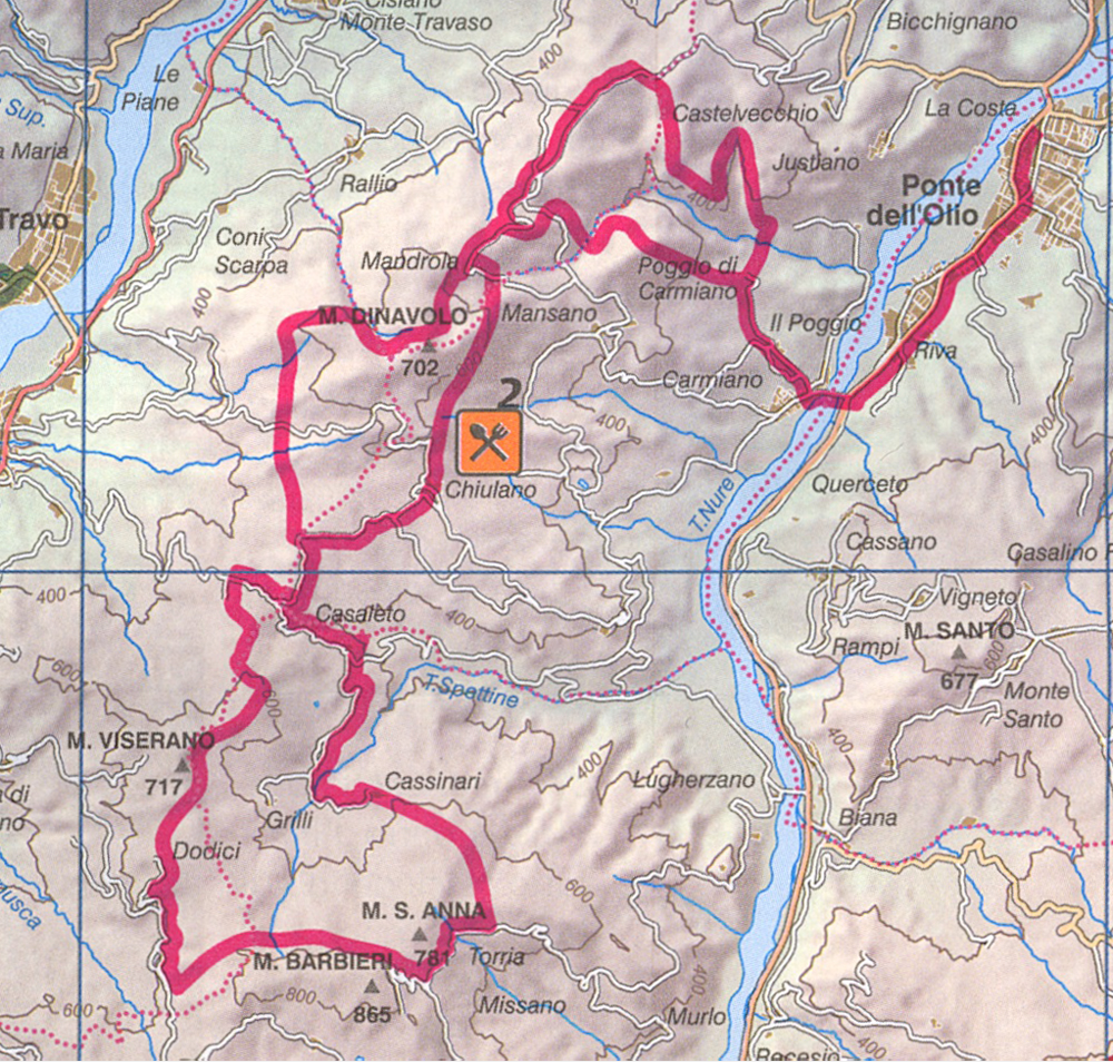
The loop between Val Nure and Val Trebbia
This route is a sequence of ascents and descents through forests of beech and the mountains which form the watershed between Val Nure and Val Trebbia, lettingeveryone admire the landscape and the characteristics of both valleys.
From Chiulano (520 m) there is a dirt road leads through the rocky terrain to the Denavolo Mt. The climb to Mt Denavolo is challenging and requires a good technical and physical preparation for him to confront in the saddle features rocky bottom, disconnected slopes and steps.
The summit of Mt Denavolo (703 meters) opens the view on Trebbia where monoliths stand of Pietra Parcellara and Pietra Perduca. After crossing Trebbia, take a steep descent into the woods, among the pines, sometimes challenging, until the country Denavolo (423 m).
Altitude regains quickly on a cattle track to the foot of the oratory of Castellaro (550 m), an ancient place of worship where every year the homonymous village festival takes place. Take the trail to Monte S. Anna alternating strokes in the woods a short ride on asphalt.
At the top (750 m), apply for a short distance at high altitude, then continue through the forest paths in a succession of ups and downs until Monte Bello (646 m) and then decrease again at the foot of the oratory of Castellaro , to return to Chiulano on asphalt.
There are numerous variants that reduce or extend the path. the more experienced bikers will find a good workout on this journey uphill and downhill fun!